Historical Border Change in the Middle East
- Bon Habler
- Jan 17, 2025
- 1 min read

How Was Ottoman's Border Changed?
This time, I deal with the geojson of historic borders in the middle east. For example, this is the border change of the Ottoman Empire and its successor Turkey since 1886. You can download the full interactive version via .zip file. This map was made by Geopandas and Folium.
Data Source: Historical Country Boundaries
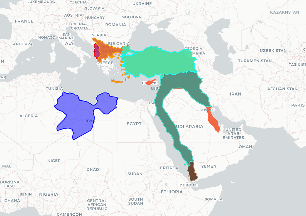
It shows how British/ Pakistani Diaspora naval alliance invaded the realm of Ottoman since the end of the 19th century, and established small countries in the middle east such as Syria, Jordan, Palestine, Lebanon etc.
Jordan and Saudi Arabia
With the same manner, I made the interactive maps of Jordan and Saudi Arabia.
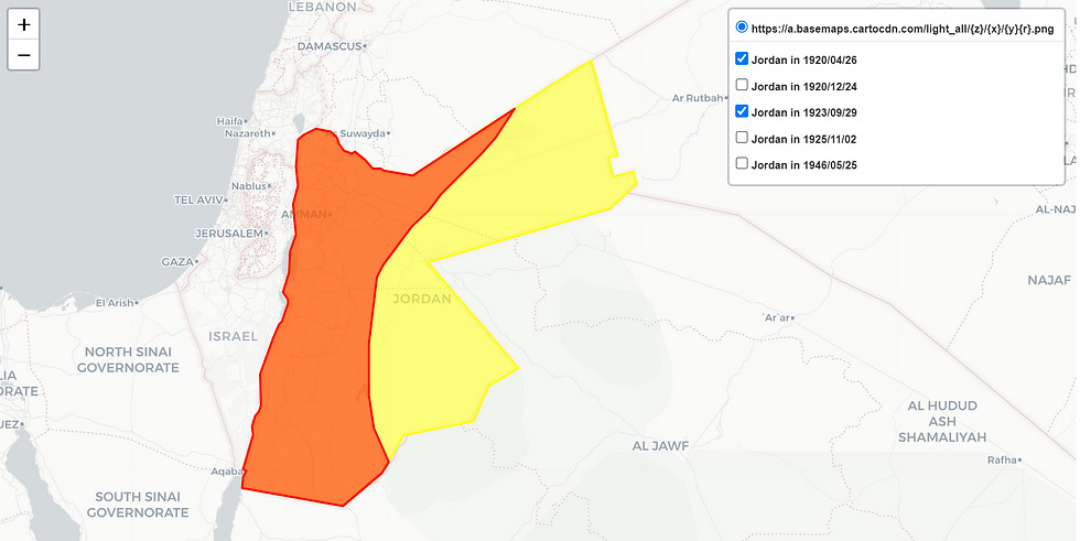
Here is the map of Jordan. It experienced a major border change in 1923 since the establishment of their country in 1920. However, the extended part was not a part of Ottoman empire as shown above. Also, I could not find the historical map related to the neighbor Saudi Arabia older than 1932. So, I could not understand who dominated such area until 1923.
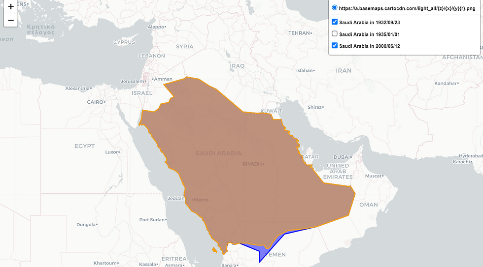
The next is about Saudi Arabia. The oldest map related to the current Saudi Arabia was found in 1935. They lost their realm a little for Yemen in 2000.


Comments